impressions


Details
| Difficulty | difficult |
| Stamina | |
| Experience | |
| Landscape | |
| Highest point | 2556 m |
| Lowest point | 1438 m |
| May | Jun | ||
| Jul | Aug | Sep | Oct |
EMERGENCY CALL:
140 Alpine Emergencies Austria-wide
144 Alpine Notfälle Vorarlberg
112 Euo emergency call (works with any mobile phone/network)
www.vorarlberg.travel/sicherheitstipps
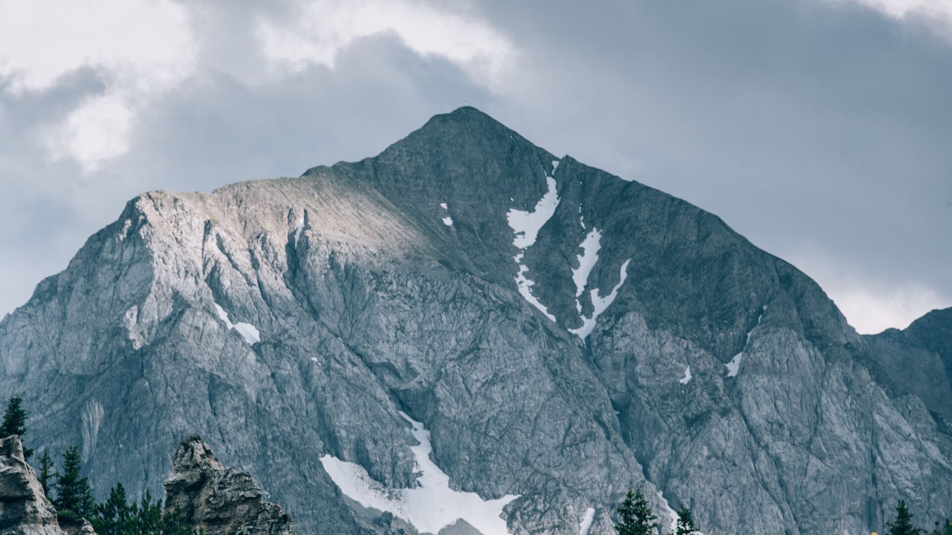
Vom Ortszentrum Lech aus gehen wir in Richtung Omesberg. Schnell verlassen wir die Straße und gehen auf einem flachen Waldweg in Richtung Omeshorn. Nach etwa 30 Minuten passieren wir ein Viehgatter, danach wird der Weg bald schmaler. Am Berghang entlang erreichen wir die Gstüt-Alpe. Hier können wir uns kurz ausruhen und eine erste Pause machen, während wir die Pferde auf den Bergwiesen beobachten. Dann geht es auf einem schmalen Pfad um das Omeshorn herum weiter, bis wir zu einer Abzweigung kommen. Wir folgen der Beschilderung in Richtung Omeshorn nach links. Vor uns liegen große Felsbrocken, auf denen einige Leute gerne bouldern würden. Etwa 30 Minuten nach der Abzweigung erreichen wir den Gipfelhang. Der Weg hier ist sehr steil und schmal, weshalb Trittsicherheit und Schwindelfreiheit erforderlich ist. Außerdem führt der Weg über eine steile Graswiese, weshalb der Weg absolut trocken sein sollte (vermeiden Sie das Wandern nach Regentagen). Für den Gipfelhang und die anschließende Wanderung über den Grat zum Gipfel wird etwa 1 Stunde benötigt. Die Aussicht ist natürlich die Mühe wert. Der Blick auf Lech, Zug und hinüber nach Zürs und Oberlech, die mächtigen Gipfel Wöster, Valluga und Mohnenfluh ... von diesen Bergen kann man gar nicht genug bekommen. Nach einer ausgiebigen Gipfelrast erfolgt der Abstieg über den Aufstiegsweg, alternativ kann die Tour auch in Zug am Fischteich begonnen werden. Insgesamt wird die Wanderung etwas kürzer, aber der Beginn ist steiler.
By train to Langen am Arlberg station or St. Anton am Arlberg. From there, buses (No. 750+760) run regularly to Lech Zürs am Arlberg.
From Germany: Take the A96 motorway to Bregenz from there on the A14 motorway to Bludenz, continue on the S16 to the Lech Zürs am Arlberg exit. Follow the B197 up to Alpe Rauz, turn left here onto the B198 through Flexengalerie and over the Flexenpass to Lech Zürs am Arlberg.
From Switzerland: Via the A13 motorway and the Feldkirch, Hohenems or Lustenau border crossing on the A14 motorway to Bludenz. Continue on the S16 until exit Lech Zürs am Arlberg. Follow the B197 up to Alpe Rauz, turn left here onto the B198 through Flexengalerie and over the Flexenpass to Lech Zürs am Arlberg.
From Austria: Via the Inntalautobahn A12 and then via the S16 to the exit St. Anton am Arlberg (Arlberg Pass). Follow the B197 first through St. Anton, then through St. Christoph and over the Arlbergpass to Alpe Rauz. Turn right here onto the B198, drive through Flexengalerie and over the Flexenpass to Lech Zürs am Arlberg.
You can either park your vehicle directly at your host or park it in the underground garage in Anger. The underground car park is located directly in the centre of town opposite Raiffeisenbank Lech.
Good footwear (ankle high, profile sole), rain protection, Lech Card and bus timetable.