impressions


Details
| Difficulty | difficult |
| Stamina | |
| Experience | |
| Landscape | |
| Highest point | 2632 m |
| Lowest point | 1450 m |
| Jun | |||
| Jul | Aug | Sep | Oct |
EMERGENCY CALL:
140 Alpine Emergencies Austria-wide
144 Alpine Notfälle Vorarlberg
112 Eruo emergency call (works with any mobile phone/network)
www.vorarlberg.travel/sicherheitstipps
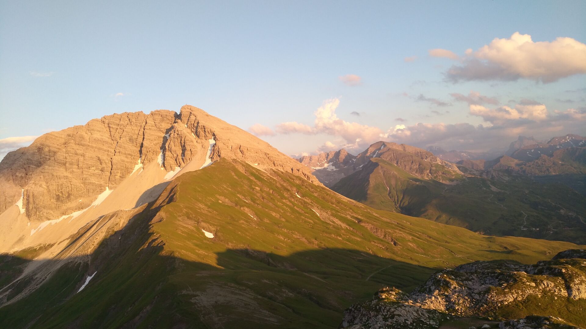
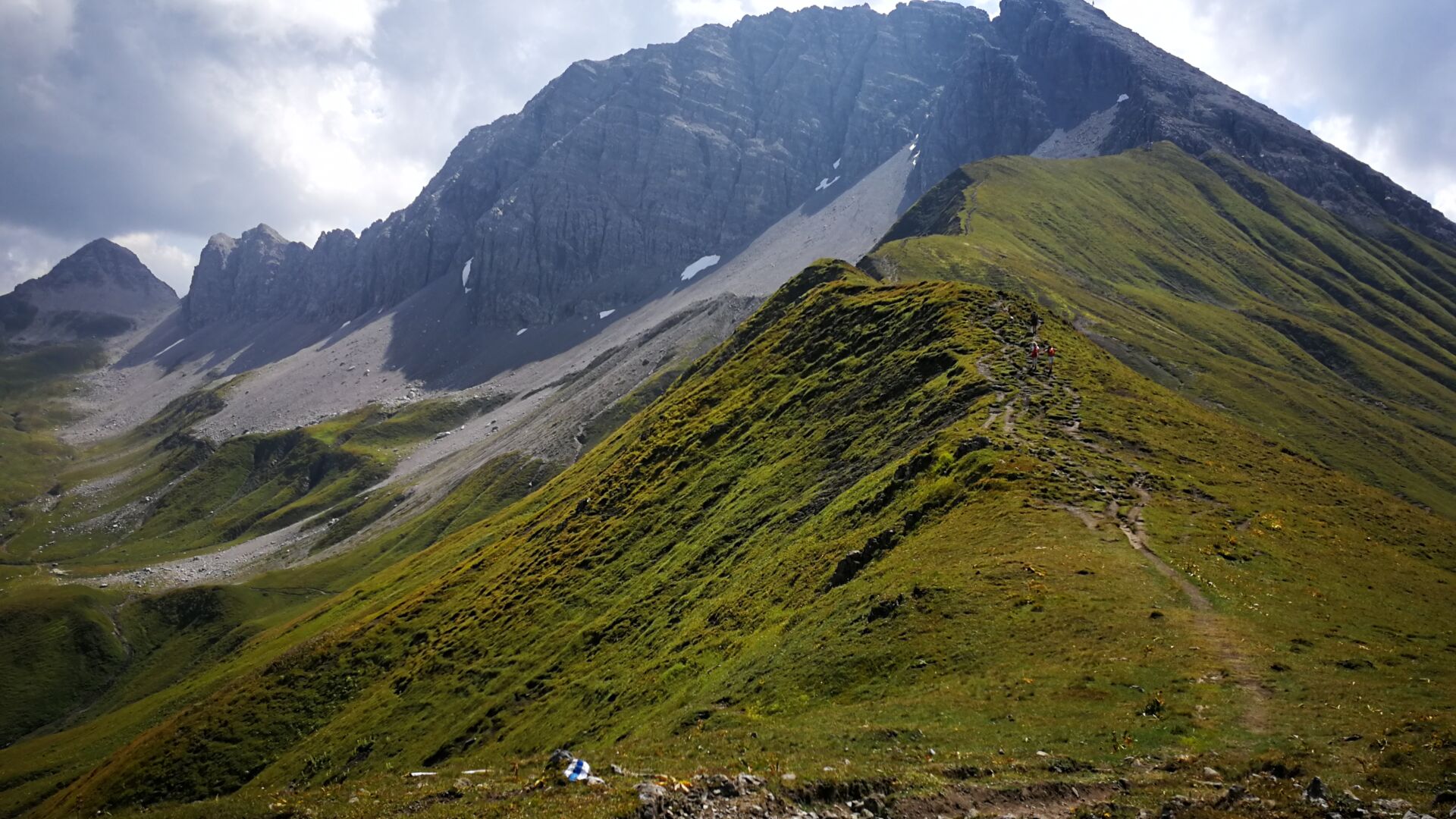
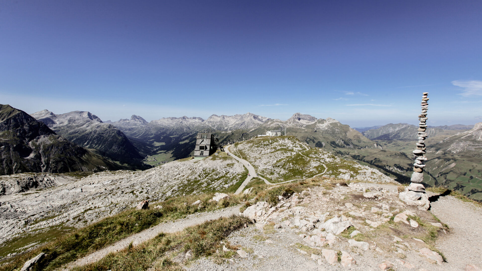
From the hike starting point at the Rüfiplatz you reach the Rüfikopfbahn cable car. Take the cable car to the (1) Rüfikopf top station (2,350 m). Then take the wide alpine path straight ahead downhill until you reach the signpost. A short ascent to a pass follows. From there, continue on a steep path with hairpins down to the saddle to the north-western ridge of the Rüfispitze. Keep going along the ridge. At the end of the grass ridge, there is a small cliff ascent that is secured by steel ropes. Continue across rocks and boulders to the (2) Rüfispitze peak (2,632 m). This provides a wonderful view of the glittering (3) Monzabonsee Lake. Take the same path back to the saddle. A path then branches off to the right, which you take going downhill to the plain of the (4) Ochsengümple. After crossing a river, continue along a mountain ridge, ascending slightly, until you reach the intersection with the Friedrich-MeyerWeg. Follow the road below the Wösterspitzen peaks to the left until you reach the (5) Wöster saddle. The path becomes slightly wider and descends in hairpins to the Tälialpe. Follow the alpine path further keeping to the left going downwards until you reach a paved back road in the (6) Stubenbach district. Follow the road to the bus stop. From here, you can take the hiking bus back to the starting point or you can take the Flühenweg described above back to Lech am Arlberg town centre.
By train to Langen am Arlberg station or St. Anton am Arlberg. From there, buses (No. 750+760) run regularly to Lech Zürs am Arlberg.
From Germany: Take the A96 motorway to Bregenz from there on the A14 motorway to Bludenz, continue on the S16 to the Lech Zürs am Arlberg exit. Follow the B197 up to Alpe Rauz, turn left here onto the B198 through Flexengalerie and over the Flexenpass to Lech Zürs am Arlberg.
From Switzerland: Via the A13 motorway and the Feldkirch, Hohenems or Lustenau border crossing on the A14 motorway to Bludenz. Continue on the S16 until exit Lech Zürs am Arlberg. Follow the B197 up to Alpe Rauz, turn left here onto the B198 through Flexengalerie and over the Flexenpass to Lech Zürs am Arlberg.
From Austria: Via the Inntalautobahn A12 and then via the S16 to the exit St. Anton am Arlberg (Arlberg Pass). Follow the B197 first through St. Anton, then through St. Christoph and over the Arlbergpass to Alpe Rauz. Turn right here onto the B198, drive through Flexengalerie and over the Flexenpass to Lech Zürs am Arlberg.
You can either park your vehicle directly at your host or park it in the underground garage in Anger. The underground car park is located directly in the centre of town opposite Raiffeisenbank Lech. Opening hours 07:00 - 20:00 o' clock.
Good footwear (ankle high, profile sole), rain protection, Lech Card and bus timetable.