Tours
The Green Ring - 2nd Leg
impressions


Details
| Difficulty | difficult |
| Stamina | |
| Experience | |
| Landscape | |
| Highest point | 2437 m |
| Lowest point | 1484 m |
| Jun | |||
| Jul | Aug | Sep | Oct |
IN CASE OF EMERGENCY call:
140 Alpine Emergencies throughout Austria
144 Alpine Emergencies Vorarlberg
112 Euro-Emergency-Call (works with every mobile phone / in every net)
http://www.austria-holidays.info/en/hiking-mountains-austria/orientation-and-safety-1658504.html
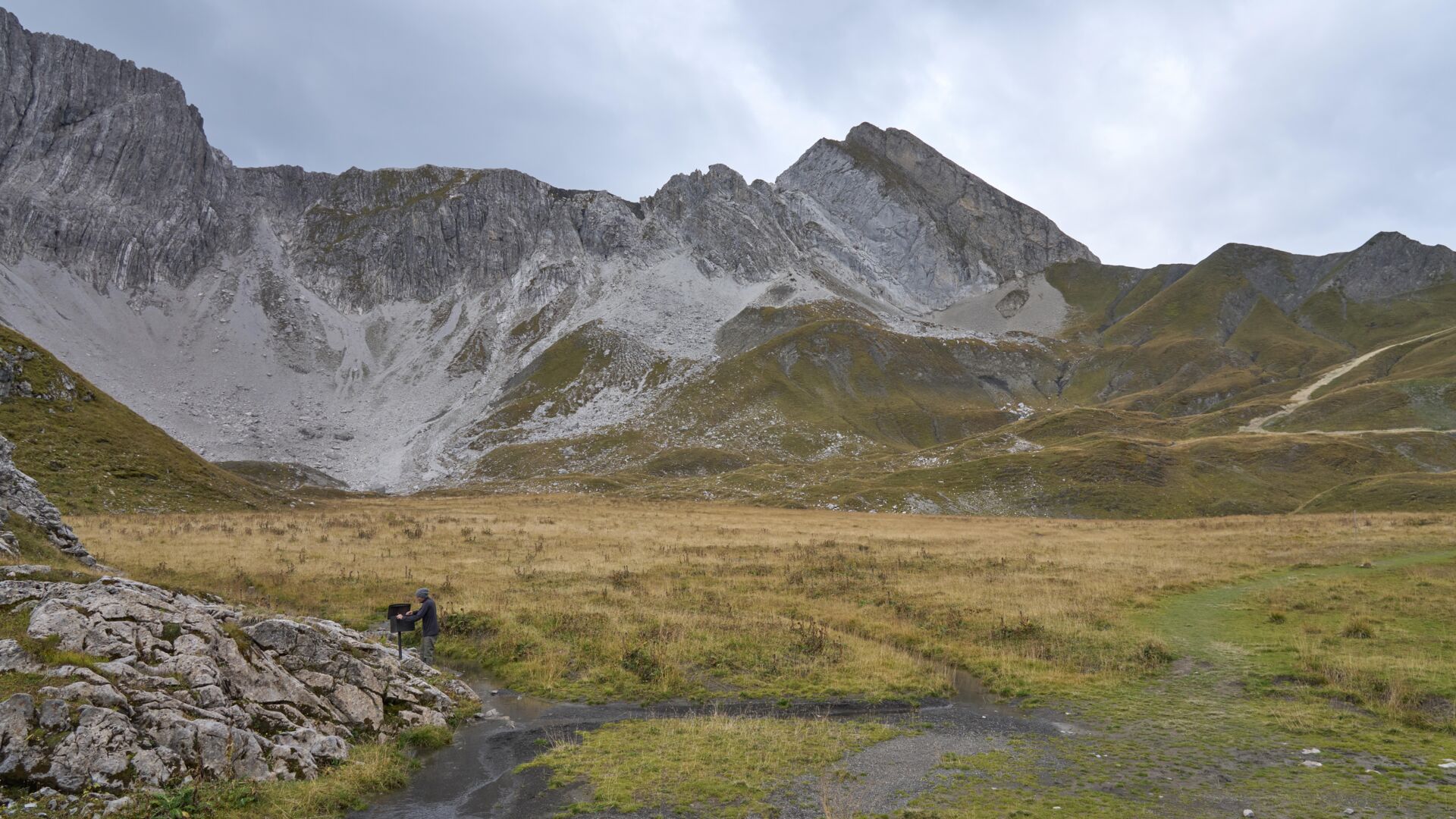
Take the hiking bus towards Zürs directly from the hike starting point at the post office. Get off at the Zürs stop and walk along the main road until you reach the roundabout. Shortly after the roundabout, take the supply road going steeply uphill with hairpin bends until you reach the (1) Zürsersee Lake and then continue uphill to the (2) Taurins cave and past the (3) Gate until you reach the (4) Glacial city of Madloch, then on up to the highest point of the Madlochjoch Pass, where you will find a (5) book which you can sign. From there, a narrower path leads through partially karsified terrain downhill to the pass between the Stierlochkopf and the Zuger Mittagsspitze. Up here you can see the (6) bivouac. Follow the hairpins downhill past (7) Taurin the Giant until you reach another hiking trail. Keep to the right and then turn left going downhill shortly afterwards. Continue downhill until you reach the Lechweg trail. Here, you can turn left and take a short detour to the (8) waterfall and the barbecue site. Or you can stay on the trail and walk past the (9) fish pond until you reach the bus stop in Zug town centre. From here, you can take the hiking bus back to the starting point. Those who have not had enough yet can turn right onto the Lech riverbank path and take a nice stroll back into Lech am Arlberg.
By train to Langen am Arlberg station or St. Anton am Arlberg. From there, buses (No. 750+760) run regularly to Lech Zürs am Arlberg.
From Germany: Take the A96 motorway to Bregenz from there on the A14 motorway to Bludenz, continue on the S16 to the Lech Zürs am Arlberg exit. Follow the B197 up to Alpe Rauz, turn left here onto the B198 through Flexengalerie and over the Flexenpass to Lech Zürs am Arlberg.
From Switzerland: Via the A13 motorway and the Feldkirch, Hohenems or Lustenau border crossing on the A14 motorway to Bludenz. Continue on the S16 until exit Lech Zürs am Arlberg. Follow the B197 up to Alpe Rauz, turn left here onto the B198 through Flexengalerie and over the Flexenpass to Lech Zürs am Arlberg.
From Austria: Via the Inntalautobahn A12 and then via the S16 to the exit St. Anton am Arlberg (Arlberg Pass). Follow the B197 first through St. Anton, then through St. Christoph and over the Arlbergpass to Alpe Rauz. Turn right here onto the B198, drive through Flexengalerie and over the Flexenpass to Lech Zürs am Arlberg.
You can either park your vehicle directly at your host or park it in the underground garage in Anger. The underground car park is located directly in the centre of town opposite Raiffeisenbank Lech.
Good shoes (ankle high, outsole), rainwear, Lech Card and bus schedule.